History
Human history in American Samoa dates back about 3,000 years, making the Samoan culture the oldest in Polynesia. Archaeological evidence dating to that time has been found at eastern Tutuila Island and on Ofu Island. With the exception of Ta`u, the Samoan islands were under Tongan conquest from 1200 to 1400 C.E..
The first European contact came in 1722 and 1768 when Dutch explorer Jacob Roggeveen and French explorer Louis-Antoine de Bougainville traded with islanders in the Manu`a island group. Subsequent outside visitors included other European explorers, Christian missionaries, and whaling ships. From the 1850s on, a steadily increasing number of European and American traders operated on Tutuila, while Manu`a remained relatively isolated.
By the 1880s, Britain and Germany had laid claim to the islands. In March 1889, German, English, and American warships stood ready to go to war over possession of the islands, but the impending battle never took place because of a hurricane. In 1899 (though not effective until February 16, 1900), Germany, England, and the United States (note the absence of Samoan representation) signed a tripartite agreement that granted control of Upolu and Savai`i to Germany and control of Tutuila, Aunu`u, and Manu`a to the United States. That year, the U.S. Department of the Navy assumed administration of “Tutuila Station.” The matais, or chiefs, of Tutuila and Aunu`u ceded these islands to the U.S. on April 17, 1900. The king and matai of Manu`a did not sign a deed of cession for Ta`u, Ofu, Olosega, and Rose Atoll to the U.S. until 1904. Several years later, the Navy began to refer to the region as “American Samoa.”
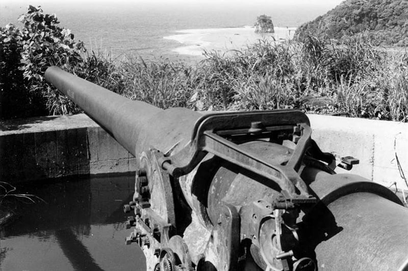
Although American Samoa remained largely insulated from World War I, during World War II, the American Samoa Defense Group (headquartered at Naval Station Tutuila) was the largest defense group in the Pacific and experienced Japanese scout overflights and submarine fire. In 1951, per Executive Order 10264, administration of American Samoa transferred from the Department of the Navy to the Department of the Interior. The Secretary of the Interior enabled American Samoans to draft a constitution under which the government of American Samoa now functions.
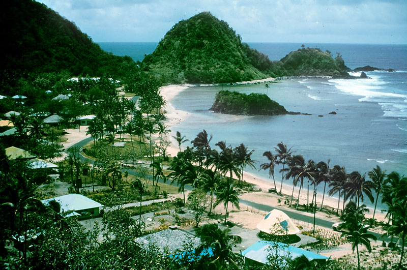
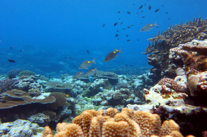
In response to a proposal from the government of American Samoa, NOAA designated Fagatele Bay National Marine Sanctuary in 1986. One of the reasons for designation was “to protect and preserve an example of a pristine tropical marine habitat and coral reef terrace ecosystem of exceptional biological productivity” (51 Federal Register [FR] 15878). From 1986 through 2012, the sanctuary consisted solely of one 0.25 square mile site at Fagatele Bay (on the southwestern coast of Tutuila Island). In 2005, NOAA established the Sanctuary Advisory Council to provide advice and recommendations to the sanctuary superintendent on sanctuary protection and management.
In 2012, as part of the culmination of a sanctuary management plan review process that included extensive community input, NOAA expanded the sanctuary to 13,581 square miles of nearshore coral reef and offshore open ocean waters by designating sanctuary areas at Fagalua/Fogama`a (the next bay east of Fagatele) on Tutuila Island, as well as at Aunu`u, Ta`u, and Swains islands, and an area at Rose Atoll and nearby Vailulu`u Seamount. To reflect the incorporation of areas across the archipelago, NOAA changed the sanctuary’s name to National Marine Sanctuary of American Samoa.
Sources
Craig, P. (2009). Natural History Guide to American Samoa. 3rd Edition. (pp. 131) National Park of American Samoa, Department Marine and Wildlife Resources and American Samoa Community College.
Davidson, J. M. (1969). Settlement patterns in Samoa before 1840. Journal Polynesian Society, 78, 44-88.
Enright, J. and the staff of the American Samoa Historic Preservation Office. (1997). The Past Surrounds Us: Historic Preservation in American Samoa. Leone,American Samoa: American Samoa Historic Preservation Office.
Linnekin, J., Hunt, T., Lang, L. and McCormick, T. (2006). Ethnographic Assessment and Overview, National Park of American Samoa. Technical Report 152. (pp.203) Pacific Cooperative Parks Study Unit. University of Hawaii at Manoa.
Office of Insular Affairs U.S. Department of the Interior (2010, Last updated April 6, 2010). American Samoa. [Website]. Retrieved from http://www.doi.gov/oia/Islandpages/asgpage.htm, May 26, 2010.
U.S. Department of Labor (2010). Information on American Samoa Geography, History, Culture, Government, and Economics. [Website]. Retrieved from http://www.dol.gov/whd/AS/sec2.htm, June 21, 2010.