Places to go
National Marine Sanctuary of American Samoa is made up of six sanctuary management areas and a visitor center with exhibits and tours that are free to the public. Let us be your guide as you explore the largest and most remote sanctuary sites in American Samoa.
National Marine Sanctuary of American Samoa
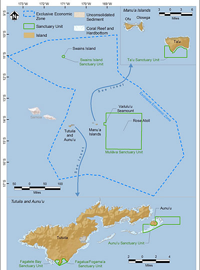
The sanctuary is located in both territorial and federal waters of the U.S. territory of American Samoa. American Samoa constitutes the eastern portion of the Samoan archipelago, a 301 mile (485 kilometer) long volcanic island chain in the South Pacific Ocean region of Polynesia. American Samoa is midway between Hawai'i and New Zealand.
American Samoa is the only U.S. territory south of the equator and comprises seven land masses: five volcanic islands and two coral atolls.
From west to east, American Samoa's islands are Tutuila, Aunu`u, Ofu, Olosega, and Ta`u. Ofu, Olosega, and Ta`u are collectively known as the Manu`a Islands. American Samoa's two atolls are Rose Atoll and Swains Island. Rose Atoll is about 100 miles (160 kilometers) east of Olosega, and Swains Island is about 200 miles (320 kilometers) northwest of Tutuila. The sanctuary includes areas at Tutuila, Aunu`u, Ta`u, Rose Atoll, and Swains Island. See below for maps and descriptions.
Fagatele Bay
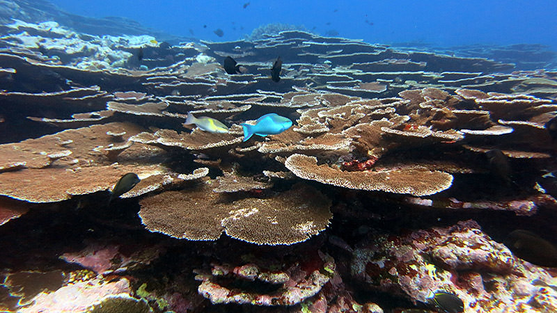
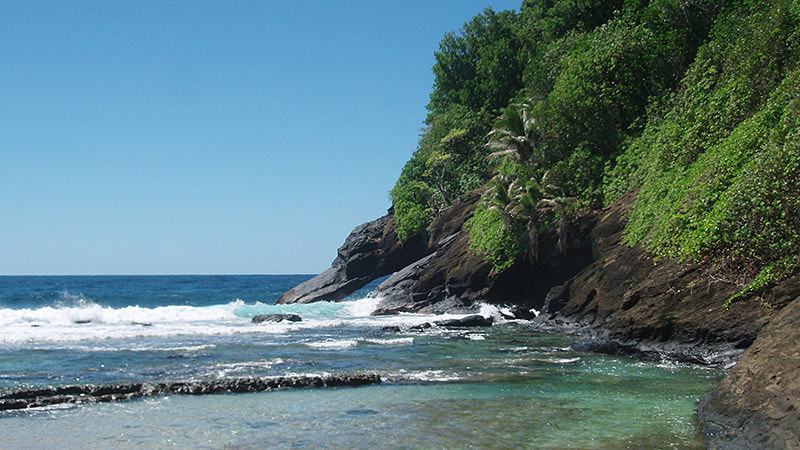
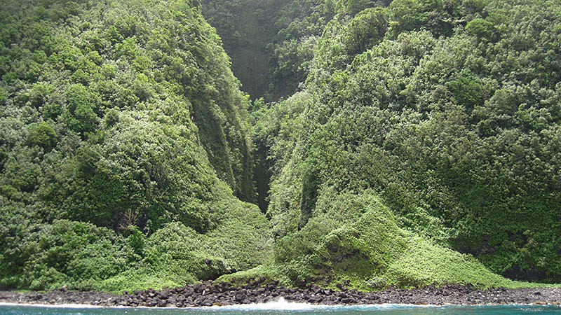
Fagatele Bay is a 0.25 square mile (0.65 square km) coastal bay that extends from Fagatele Point to Steps Point along the southwestern coast of Tutuila Island. This naturally protected bay was formed by a collapsed volcanic crater and is surrounded by steep, forested cliffs.
Fagatele Bay can be accessed from the village of Futiga from 7:30 a.m. to 4.00 p.m. Monday to Friday, and 7.30 a.m to 1.30 p.m. on Saturdays. Interested visitors or groups to the bay must check in with Mr. Asuemu Fuimaono's family prior to passing beyond the gate, and pay a customary fee of $5. The access lands are maintained by the Fuimaono family and the entrance fee helps with costs of maintenance.
Fogama`a / Fagalua
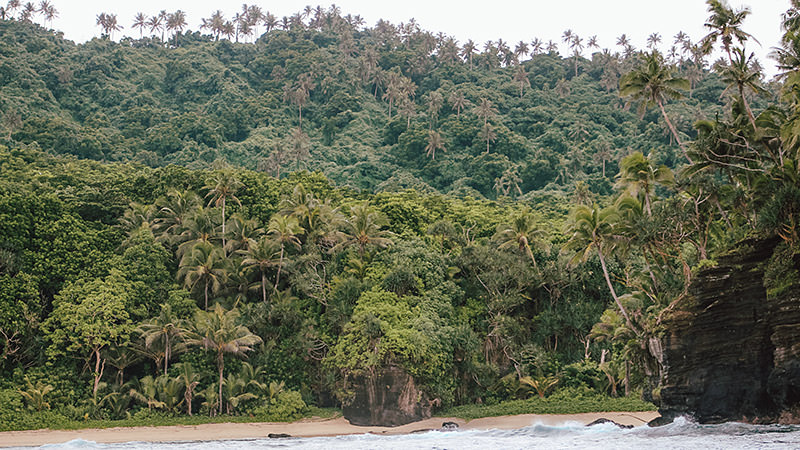
Fogama`a/Fagalua is just east of Fagatele Bay on Tutuila Island and is slightly larger, at 0.46 square miles (1.2 square kilometers). Fogama`a and Fagalua coves make up the inner western portion of the entire bay area, which extends from Steps Point to Sail Point Rock. Like Fagatele Bay, Fogama`a and Fagalua were formed by a flooded volcanic crater and are surrounded by steep, forested cliffs. Fogama`a Cove is also known as Larson's Cove, and can be accessed from Vaitogi village.
Aunu`u Island
Aunu`u is a small, volcanic island approximately 1.2 miles (2 kilometers) southeast of Tutuila. Its land area is 0.6 square miles (1.5 square kilometers). The marine sanctuary area encompasses 5.8 square miles (15 square kilometers) and borders the island on three sides. Its boundaries are established based on identifiable landmarks (e.g., Taugamalama Point, Salevatia Point) to assist boat-based users in identifying whether they are within or outside sanctuary boundaries.
Ta`u Island
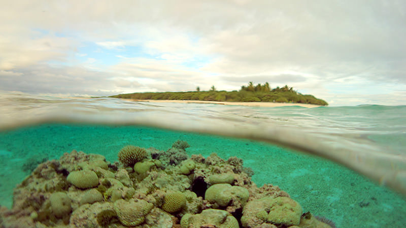
Ta`u, part of the Manu`a island group, is a volcanic island located 93 miles (150 kilometers) northeast of Tutuila Island. Ta`u is ringed by extremely steep sea cliffs and a steeply-dropping seafloor. The island has a south-facing embayment, the result of collapse and landslides off the remnants of a southern caldera similar to the Fagatele Bay formation.
The Ta`u Island sanctuary area encompasses 14.6 square miles (37.8 square kilometers) and includes waters from Vaita Point to Si`ufa`alele Point along the western coast, and from Si`ufa`alele Point to Si`u Point along the southern coast. The inner sanctuary boundary along the southern coast is adjacent to, but does not include, the nearshore waters of National Park of American Samoa, which extend 0.25 nautical miles from shore.
Muliāva (Rose Atoll and Vailulu`u Seamount)
The Muliāva sanctuary area encompasses 13,507.8 square miles (34,985.04 square kilometers). It includes the marine waters of Rose Atoll Marine National Monument and waters surrounding the Vailulu`u Seamount, the only hydrothermally active seamount within the American Samoa EEZ. Rose Atoll is approximately 150 miles (240 kilometers) east-southeast of Tutuila Island's Pago Pago Harbor. It is the easternmost Samoan landmass, the southernmost point of the United States, and one of the smallest atolls in the world. The inner sanctuary boundary is adjacent to the seaward boundary of Rose Atoll National Wildlife Refuge. The sanctuary does not include the land or lagoon waters that make up the refuge.
Swains Island
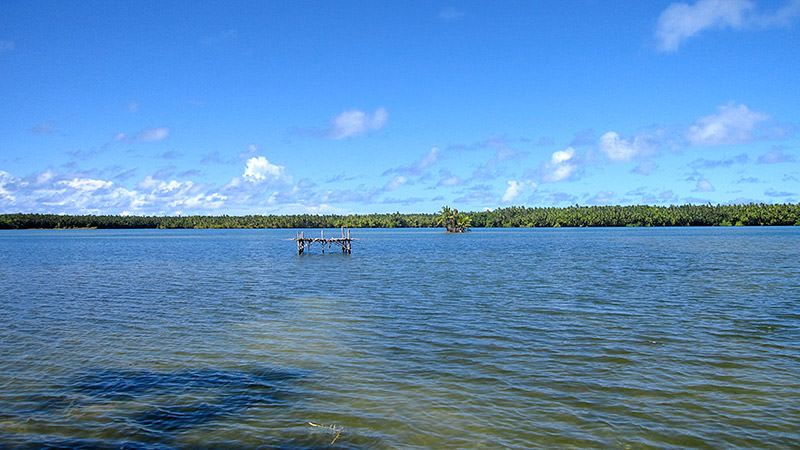
Swains Island is a low-lying emergent seamount and coral atoll located about 200 miles (350 kilometers) northwest of Tutuila. It is geologically part of the Tokelau volcanic island group and not the Samoan volcanic chain. This marine sanctuary area encompasses 52.3 square miles (135.5 square kilometers) and includes territorial waters within a three-nautical-mile circle of the island, excluding the interior lagoon and two channels between the lagoon and the sea.